
Quebec land surveyors in the Laurentians
Land surveyor in the Laurentians, from Laval to Mont-Tremblant
Selling your home, putting up a fence or building? We measure your property and prepare the signed documents your notary or municipality needs. If the result raises a question, we take the time to explain it.
- Written price and timeline before we start
- Document sent directly to your notary
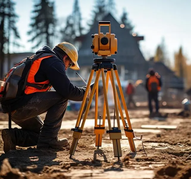
Members of the OAGQDocuments signed by a Quebec land surveyor
60 municipalitiesFrom Laval to Mont-Tremblant
Direct to your notaryWe send the signed document
No-obligation quoteA written price before any work
Our services
Land surveying services in the Laurentians
In Quebec, only a land surveyor (arpenteur-géomètre) can sign a certificate of location, stake a lot or prepare a cadastral plan. You call us to sell, to know your exact lot lines, to build, or to split a lot.
-
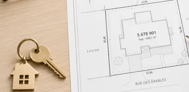
Certificate of location
Required when selling and often when refinancing. We check that the house, outbuildings and lot match the titles and by-laws.
-
Property staking
We find your lot lines and set visible markers before a fence, a hedge or work near the line.
-
Boundary determination (bornage)
The line between two neighbours, fixed for good. By agreement when possible, in court when not.
-
Building layout and implantation plan
The plan your municipality needs for the permit, then markers on site so the foundation is poured in the right spot.
-
Subdivision and cadastral operations
Splitting a lot, merging two lots or correcting the cadastre, through to registration in the Quebec cadastre.
-
Topographic survey
Elevations, slopes, trees, ditches: the survey your architect, engineer or builder needs to design the project.
-
Technical description
A precise description of part of a lot, for a notarial deed, a partial sale or a servitude.
-
Servitudes (easements)
Right of way, shared well, power line: we locate the servitude and describe it so it is registered correctly.
-
Condominium surveys
Vertical cadastre plans, condo certificates of location and conversion to divided co-ownership.
-
Waterfront properties
Shoreline buffer, high-water mark, flood zone: what to check before buying or building near a lake.
Where to start
Which service do you need?
Start from your situation. Still unsure? Call us and we'll point you in the right direction in a few minutes.
418 265-9419- I'm selling or buying a houseCertificate of location
- I'm putting up a fence and don't know where the line isProperty staking
- My neighbour and I disagree about the lineBoundary determination (bornage)
- I'm building a house, garage or additionBuilding layout and implantation plan
- I want to split my lot to sell part of itSubdivision and cadastral operations
- My project is on a lake or riverWaterfront properties
How it works
From the first call to the signed document
-
Your request
By phone or with the form. Give us the address, the service and your deadline: closing date, start of construction.
-
The quote
We review the titles and cadastre, then send a written price and timeline. Nothing starts without your OK.
-
Field work
Our crew measures the property with a total station or precision GPS. We'll tell you ahead of time if you need to be there.
-
Delivery and explanations
You receive the signed document. We can send it straight to your notary and answer your questions about the result.
Why choose us
Surveyors who know the Laurentians and take the time to explain
-
We know the territory
Suburbs of Thérèse-De Blainville, farmland in Mirabel, sloped lots in the Pays-d'en-Haut, cottages on the water: every area has its own rules and pitfalls. We know them before we arrive.
-
A written price and timeline
You know what you will pay and when you will get your document before we start. No surprises at delivery.
-
Clear explanations
A certificate that flags an encroachment or a setback problem can be worrying. We explain what it means for your sale and what your options are.
-
We work directly with your notary
Give us your notary's details and the signing date. As soon as the document is signed, we send it to them: you don't have to play messenger.
-
Signed by a member of the Order
Every document is prepared and signed by a land surveyor who is a member of the Ordre des arpenteurs-géomètres du Québec, the professional order that regulates the profession.
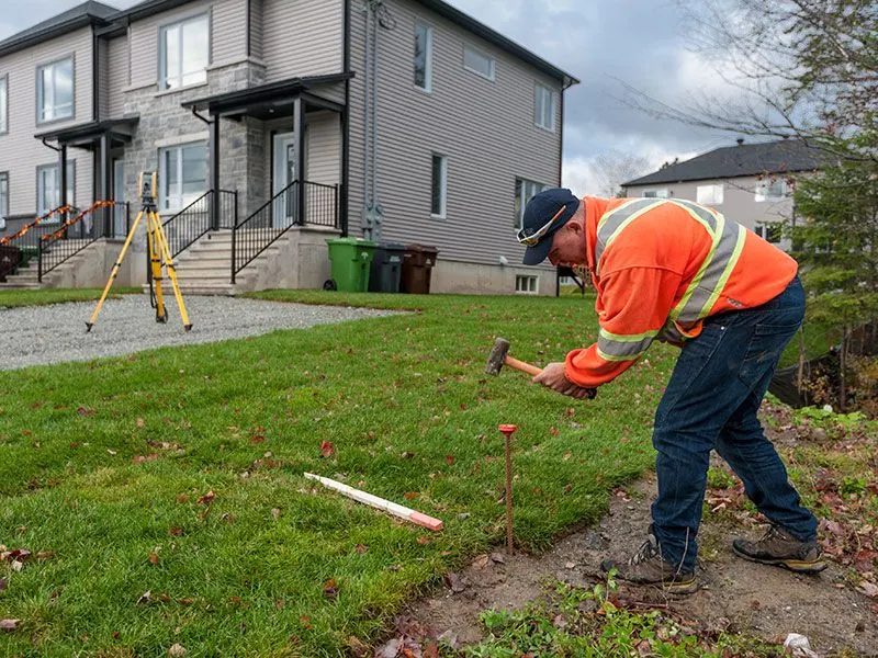
Closing date coming up? Tell us on your first call.
Service areas
Land surveyor in 60 municipalities, from Laval to Mont-Tremblant
Our office is in Val-David. Pick your area to see the municipalities we travel to.
City · 14 neighbourhoods
City of Laval
All 14 neighbourhoods of Île Jésus, between the Rivière des Prairies and the Rivière des Mille Îles.
7 municipalities
Thérèse-De Blainville RCM
Established suburbs along the Rivière des Mille Îles, plus the farmland of Sainte-Anne-des-Plaines.
7 municipalities
Deux-Montagnes RCM
Lac des Deux Montagnes, the Rivière des Mille Îles and the orchards of Saint-Joseph-du-Lac and Oka.
City · 13 sectors
City of Mirabel
Mirabel's 13 sectors, on territory that is overwhelmingly agricultural.
5 municipalities
La Rivière-du-Nord RCM
Saint-Jérôme and its neighbours: urban streets, wooded lots and the lakes of Saint-Hippolyte.
9 municipalities
Argenteuil RCM
Lachute and a vast rural area stretching to the Ottawa River.
10 municipalities
Les Pays-d'en-Haut RCM
Mountains, ski hills, lakes and cottages, from Piedmont to Wentworth-Nord.
20 municipalities
Les Laurentides RCM
Our office is in Val-David. Hundreds of lakes, from Sainte-Agathe-des-Monts to Mont-Tremblant and La Minerve.
Your town isn't listed? Call us at 418 265-9419 and we'll tell you right away if we can help.
Testimonials
What our clients say
Client reviews will appear here, exactly as they were posted on our Google profile. We never write or edit reviews ourselves.
Frequently asked questions
Your questions about land surveying, answered
The questions we hear most often on the phone. Have another one? See the full FAQ or call us.
What is a certificate of location?
It's a document signed by a Quebec land surveyor, made up of a report and a plan. It describes your property in relation to the titles, the cadastre and the by-laws that apply: zoning, setbacks, servitudes, protected areas. The notary and the lender use it to make sure no hidden problem will affect the sale or the loan.
I'm buying in Quebec from out of province. Is this like an Ontario survey?
Not exactly. Besides showing the lot and buildings, the certificate of location includes the surveyor's opinion on compliance with titles and by-laws. In a Quebec sale, the standard offer to purchase generally requires the seller to provide one that reflects the property as it is today.
How long is a certificate of location valid?
There's no legal expiry date. It stays usable as long as it reflects the property as it is today. Any change (addition, pool, shed, fence, zoning change, new lot number) means you need a new one. The "10-year rule" you may hear about is a lender practice, not the law. See our guide.
How much does a certificate of location cost?
It depends mainly on the size and complexity of the lot, the number of buildings, the land register research and the turnaround you need. A semi-detached house on a small regular lot costs less than a waterfront cottage with a garage and a shed. Send us the address for a written price, with no obligation.
How long does it take?
It depends on the season. Spring and summer are the busiest periods. The best move is to order as soon as you list, without waiting for an accepted offer. The exact timeline is in our quote.
What's the difference between staking and boundary determination?
Staking sets markers at your lot lines according to your titles and the cadastre. Boundary determination (bornage) is a Civil Code procedure that fixes the line permanently between two neighbours, with a report registered in the land register.
Which towns do you serve?
60 municipalities, from Laval to Mont-Tremblant, including Saint-Jérôme, Mirabel, Blainville, Saint-Eustache, Saint-Sauveur and Mont-Tremblant. See all service areas.
Resources
Guides to help you prepare
-
Guide
When do you need a certificate of location?
Selling, refinancing, an addition, a new pool: when you need a new certificate, and when the old one may still do.
-
Guide
How much does a certificate of location cost?
What drives the price of a certificate of location, and how to avoid paying for a rush job.
-
Guide
Staking vs boundary determination in Quebec
Two services that are often confused. Which one you need when the line with your neighbour is in question.
No-obligation quote
Tell us about your property
Send us the address and the service you need. We'll call to confirm the details, then send a written quote.
- 418 265-9419
- info@arpenteurlaurentides.com
- 1534, rue Vinet, Val-David, QC J0T 2N0
- Monday to Friday, 8 a.m. to 5 p.m.